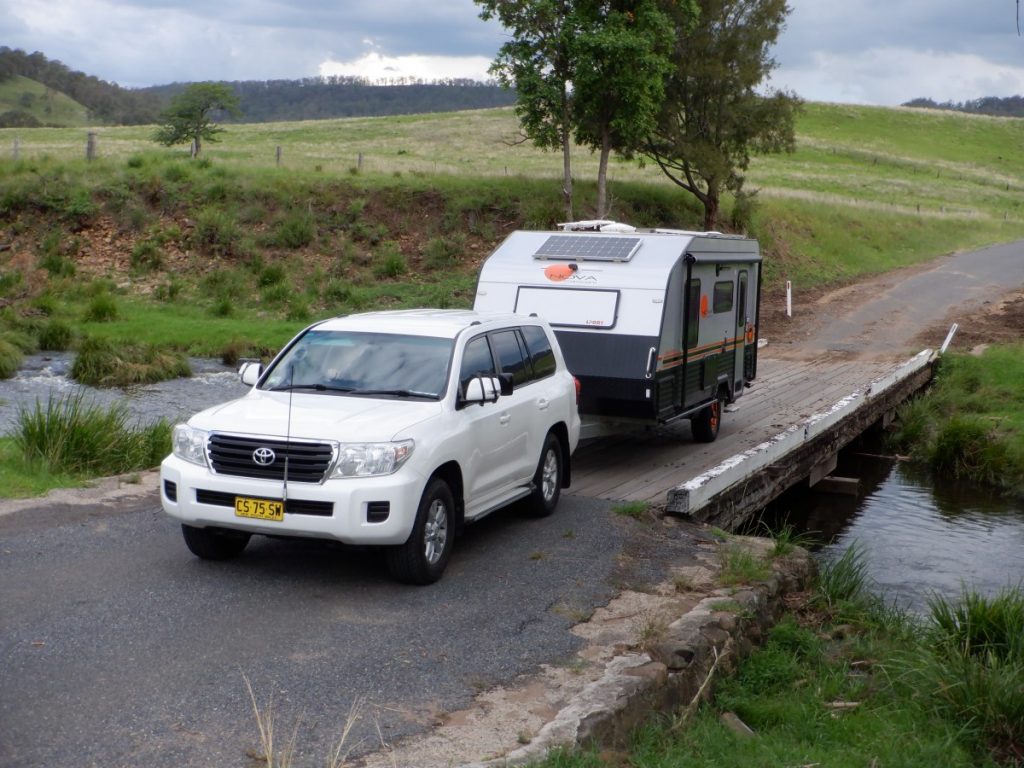
Silver Adventurers Jan and Peter (both 73) hit the road in their caravan to explore the stunning Border Loop which exists at the edges of New South Wales and Queensland.
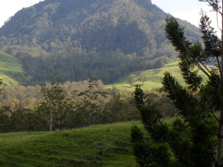
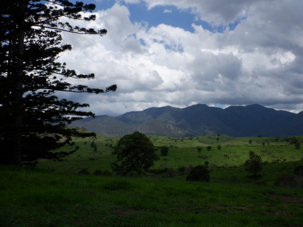
The Scenic Rim straddles Tamborine Mountain, beautiful Lake Moogerah, the rugged Mount Barney and the town of Boonah. You can expect to enjoy ancient rainforests, historic national parks, charming towns and villages, craft breweries, boutique wineries, galleries, and more. We decided to dedicate some time to this stunning region, which is so close to home.
With Covid restrictions in mind, armed with border passes and the caravan in tow, we set off. After all the rain, we wanted to see the region at its best.
CANUNGRA BORDER CROSSING ADVENTURES
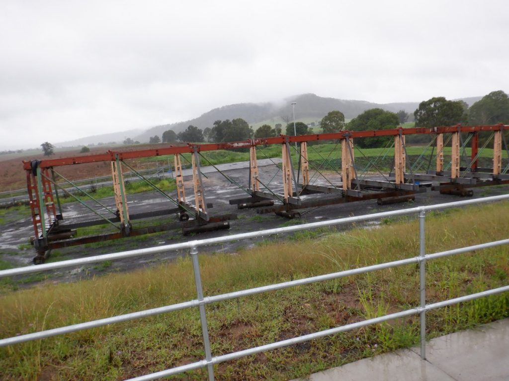
On the roadside approaching Canungra in the Gold Coast hinterland, a tourist sign caught our eye. We stopped at a short walk, which led to some information boards. Lahey’s Canungra Tramway Tunnel is a heritage-listed tunnel that is worth seeing on your journey. The Lahey family were fresh from Ireland with their 11 kids when they built the sawmill at Canungra in 1884. It was an immediate goldmine. They soon had so many contracts to cut timber from the area, that they couldn’t get it all to the sawmill by the slow and expensive bullock teams that were hauling it. They set about building a private railway line up to the rugged region where the sawmill lay.
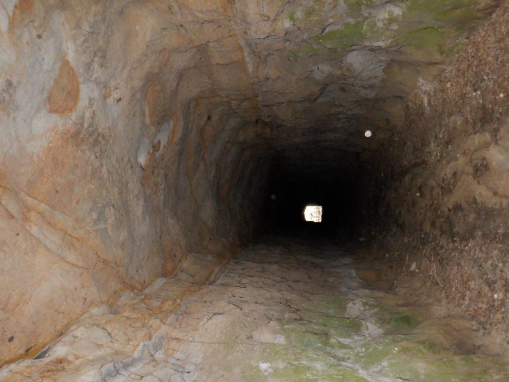
The Darlington Range separated the mill in Canungra from the timber leases in the Coomera Valley. Building a railway line around the ridge was just too expensive. So, the engineers decided to cut a tunnel through it. They succeeded, and the line was laid down. The first use of the tunnel was in 1903, and the tramline increased the productivity of the sawmill. No serious accidents occurred on the railway line, though there are reports of “some exciting moments” due to “greasy rails.”
MORE ABOUT CANUNGRA
The line was extended over time, eventually reaching 26.5km. The line curved among waterfalls, ferns and thick scrub, and it was used by the locals for everyday transportation needs. Locals sat atop the logs, children hitched rides to school, and picnickers grabbed a ride to their destinations.
Soon nearly all of the trees had been razed in the Canungra area. The mill was closed, however, trips along the tramway kept going up until 1930. By 1935, the line was dismantled and sold for scrap. During the Second World War, the tunnel was used for storage of ammunition for the nearby Kokoda Army barracks. After that, it was largely forgotten.
Upon its rediscovery, it was cleaned up using a Centenary of Federation grant project. The tunnel was officially re-opened for pedestrian and visitor use in January 2001. Romeo Lahey of the following generation, in conjunction with Arthur Groom, purchased the land to establish the nearby famous Binna Burra Lodge in 1933.
BOONAH
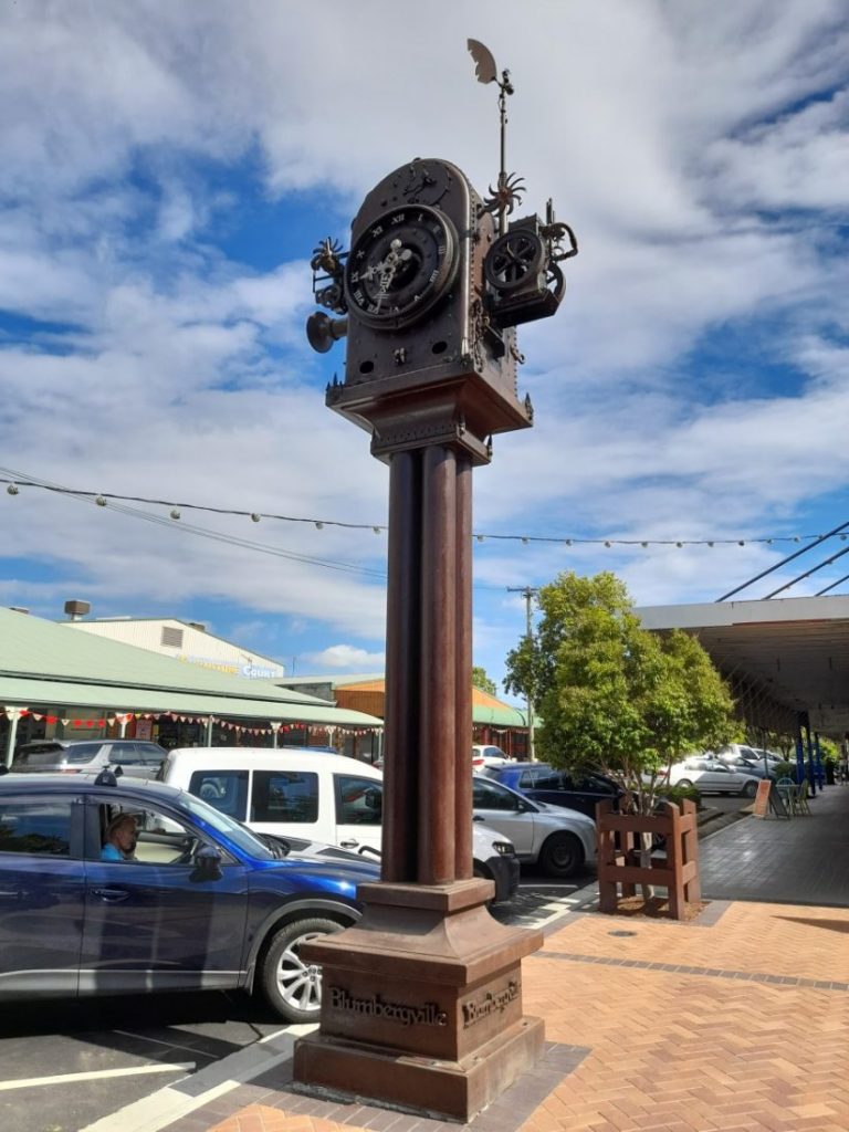
There were multiple choices of eateries for us in the main street of Boonah. (The town’s original name was Blumbergville, because of the Blumberg Brothers who established the first store). A friendly local stopped to chat as we enjoyed lunch at a footpath café. He gave us the tip to return to witness the hour striking on the fascinating Blumbergville clock in the main street. The four-tonne, five-and-a-half-metre-high town clock was made from farm equipment donated from local farms. Artist Christopher Trotter was inspired by the town’s history and put it together with local clockmaker David Bland.
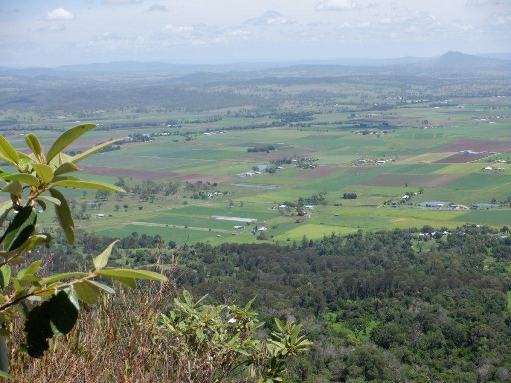
After setting up camp in the Boonah Showground, we explored Moogerah Peaks, National Park. A narrow but sealed road took us to the summit of Mt French. Logan’s Lookout and the Mee-bor-rum circuit were pleasant strolls that rewarded us with expansive views over the surrounding farmlands. We tried to check out a few of the local wineries but, prior bookings were required because of Covid. With closures until the end of the week, we were disappointed in missing a chance to visit.
JOURNEY TO KOREELAH NATIONAL PARK
From Boonah, our initial plan was to cross the border over the range via Carneys Creek Road to White Swamp and Koreelah National Park. We were aware that this border crossing was closed but decided to check it out anyway for future travel. After enjoying a generous-sized lunch at the Mt Alford Hotel, we left the caravan in their car park as we had to return this way later in the day. The countryside and mountain views up the range to the closed border gate (where we turned around) were stunning and well worth the detour. The good standard gravel road was very steep in some parts but would be passable if we were towing our van with the four-wheel-drive vehicle.
MT BARNEY
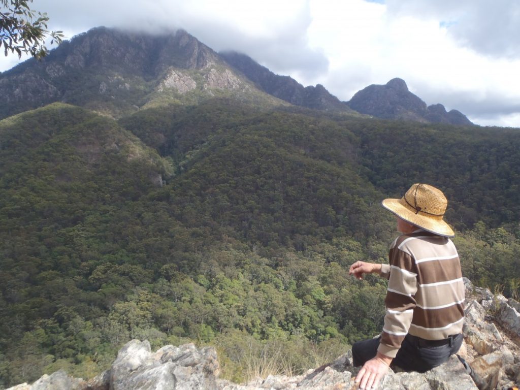
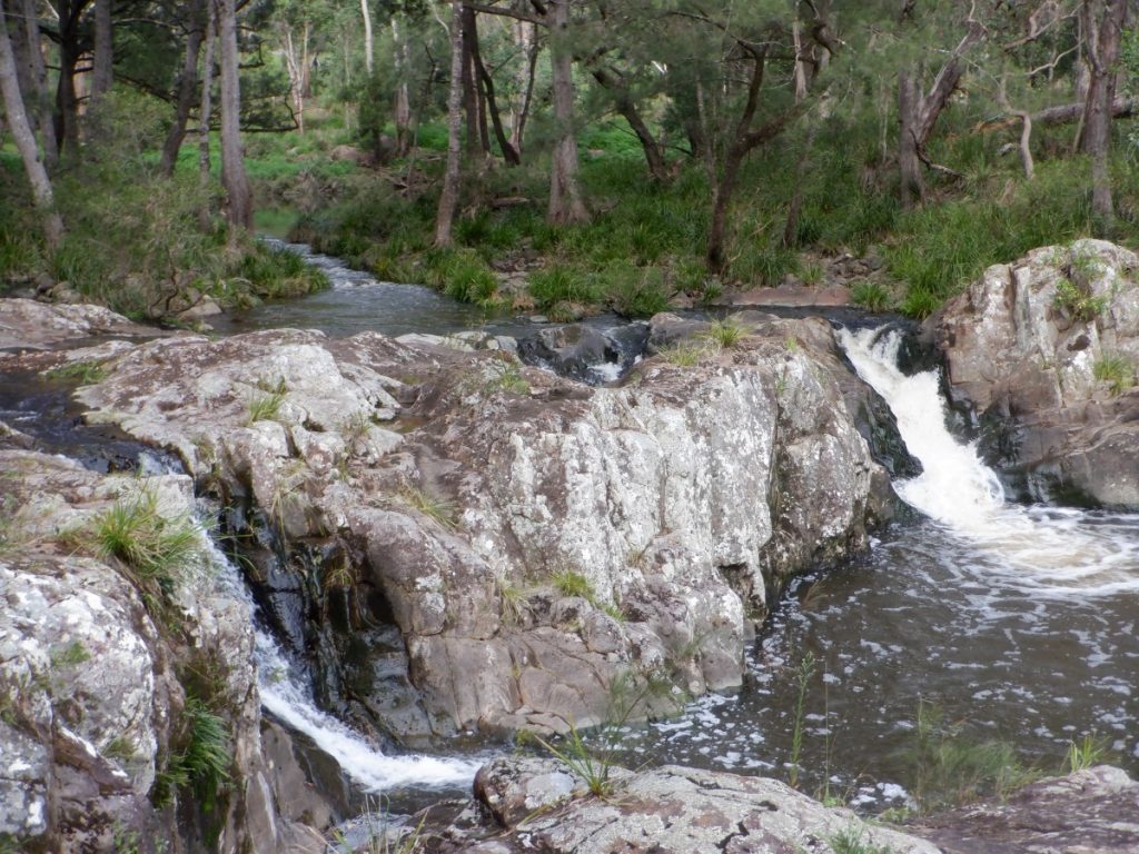
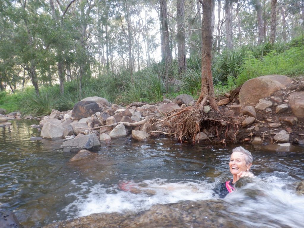
Seeing as we had to detour up the Mt Lindsey Highway to cross into New South Wales, we had an unplanned couple of days at Mt Barney Lodge. The camping ground provided us with a base from which to hike to the Lower Portals and Yellow Pinch. Lower Portals was a challenging 7.4km (return) undulating hike to a pleasant little creek. It was very inviting for a swim and a picnic from our purchases of local produce. Other hikers, loaded up with backpacks, were proceeding on a little further to a walk-in campground. The following morning, we scrambled 1.3km up Yellow Pinch to a spectacular lookout where we sat for quite a while contemplating the beautiful mountainous panorama.
MT LINDSEY HIGHWAY BORDER CROSSING ADVENTURES
We travelled through the lush green countryside on the Mt Lindsey Highway, which is dominated by Mt Lindsey, 1195m above sea level. It is one of many peaks forming part of the border between New South Wales and Queensland. This plug is from a vast volcano that covered the area approximately 20 million years ago. Apparently, these peaks are very popular with mountain climbers. We crossed into New South Wales after being waved through a border checkpoint.
In the border town of Woodenbong, we joined the locals for a drink and chat in the pub. The Yowie story caught our attention. Apparently, two sightings in the 1970s caused much media speculation and scientific teams attempted to investigate the reports.
FALSE ENCOUNTERS
Unfortunately, the women who reported the sightings were subjected to ridicule and no further sightings have been officially reported. Other alleged sightings were at the end of November 2001 and in 2003. Timber workers and a truck driver reputedly experienced close encounters.
KOREELAH NATIONAL PARK
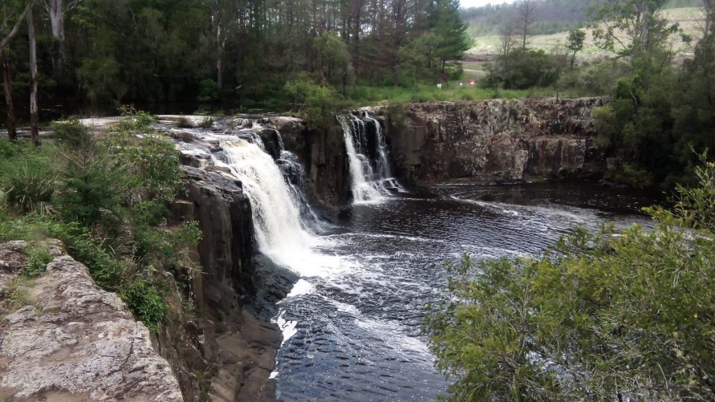
Koreelah National Park, on White Swamp Road, has a delightful remote bush camping area where we stayed for a few days. There was only one other camp, quite a distance away. We enjoyed the solitude. Alas, we couldn’t access Queen Mary Falls and Condamine Head from here because of border closures. There were lovely spots to take a dip, especially with the temperature in the 30s. With a bit of rock hopping, a walk along the top of the gorge took us to large pools below the falls. There was plenty of water over the falls and numerous bird life around us.
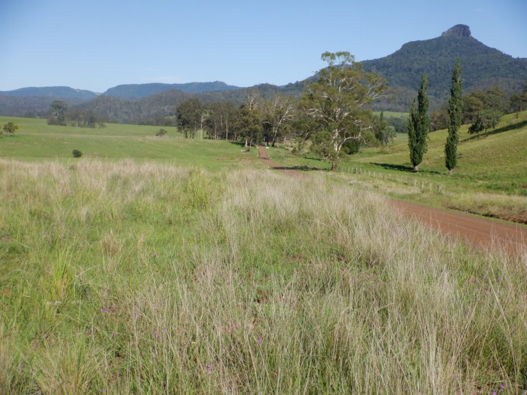
To complete the circuit we began at Mt Alford, driving through White Swamp to the News South Wales side of the border. This is a beautiful area with lush farmland surrounded by mountain ranges. It gets its name from the white flower head of the foxtail grass which is prevalent in the valley. A gravel road led us to the New South Wales/Queensland border crossing, and the border fence where once again we turned back.
White Swamp (once a village) is of historic significance. The border was relocated through here when the colony of Queensland was separated from the colony of New South Wales in 1859. The border was initially proposed to follow the 29th degree of south latitude all the way across, where the western part of the border is today. This would have put the border on the coast between Ballina and Evans Head. New South Wales was not happy to lose so many of them already[1]established farming lands north of the proposed border. So the wonky border we now have was surveyed and agreed to between the states. A monument to the two surveyors Francis Roberts and Isiah Rowland stands on the Queensland side of the border crossing.
TOOLOOM NATIONAL PARK
Reluctantly moving on from Koreelah National Park, we travelled via Old Koreelah, again onto the Mt Lindsey Highway, and along Tooloom Road. We paused at the summit of Tooloom National Park to view the surrounding countryside. As we descended through the National Park the thick rainforest vegetation closed in right up to the road.
The original plan was to camp at Tooloom Falls, a small bush camp and picnic area perched above the falls, 5km south of Urbenville. But it was closed. A short climb to swim at the bottom of the falls would have been very welcome in the summer heat. We have fond memories of a previous trip here, viewing platypus and paddling our canoe upstream of the falls.
After an alternate overnight camp at the Urbenville rest area, the van was left there for an excursion south through the Yabbra State Forest the next morning.
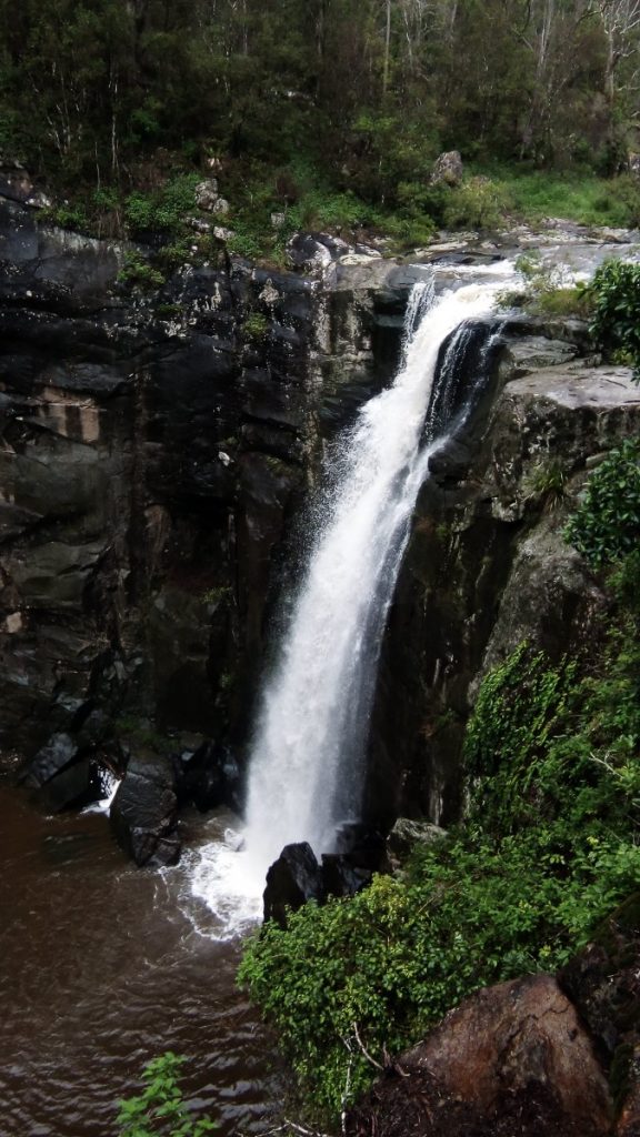
This was a highlight, with tall eucalypts combined with the tinkling call of the bellbirds in the treetops. A little further south we diverted 700m down a track which led us to a small parking area and a viewing platform for Bean Creek Falls.
Back to Urbenville and via Upper Tooloom, we ventured along Paddys Flat Road for 32km on rough gravel. It was a relief to finally descend down to the Clarence River at Paddys Flat after being reduced to 20km an hour in some of the rough sections. A swim was a respite from the dusty road just travelled.
West from here was part of ‘The Brisbane Line.’ It was dreamed up to protect the people living south of this area from a Japanese invasion during World War Two. It was an invasion that never came, of course. We wandered along the river bank to find remnants of the 26 concrete pyramids that were once connected together by a steel cable in the river. The natural boulders on the eastern side of the road were considered a barrier for the light Japanese tanks. Defensive positions were established along many roads throughout Australia. Tank traps were also placed at Thunderbolt’s Gully north of Tenterfield near an army training camp.
TABULAM
That night, in a bush camp at Hooten’s Bridge on the Clarence River, we were lashed by heavy rain. Morning brought a few breaks in the weather enabling us to pack up and move on to Tabulam where we enjoyed morning tea in the small café. We strolled into the park and viewed a monument to a local World War One hero.
Sir Henry George Chauvel was born in 1865 on the family horse and cattle property in Tabulam. He was the first Australian to attain the rank of General. He commanded the First Light Horse Brigade at Gallipoli. In 1917 he commanded the Desert Mounted Corps at the Battle of Beersheba. The final phase of the battle was the famous mounted charge of the Fourth Light Horse Brigade. This was the last great cavalry charge, and the town was captured by mid-afternoon, securing water supplies for the men and horses. 31 men were killed, 36 were wounded. 70 horses were killed. 130,000 Australian horses went to World War One.
HISTORY OF TABULAM: BORDER CROSSING ADVENTURES
13,000 returned and only one to Tabulam. On October 31, 2017, two hundred horsemen and women re-enacted the 100th anniversary of the 1st Light Horse leaving Tabulam to join World War One. They forded the Clarence River at the Showground, rode along Chauvel Road and Plains Station Road, eventually arriving at Copmanhurst three days later.
We had crossed the Clarence River at Tabulam. The longest single-span wooden truss bridge in the southern hemisphere was demolished last year when a new bridge was erected. The historic bridge had been constructed using hand tools and bullock teams. A single wooden span lies beside the highway, perhaps as a memorial to times gone by.
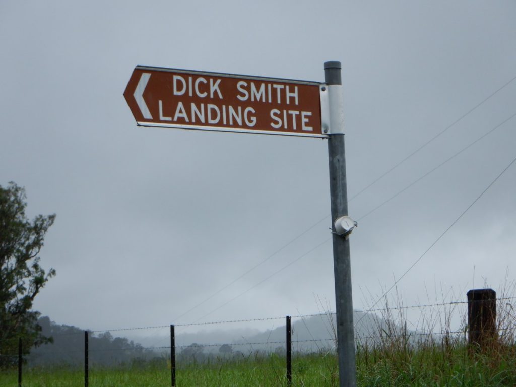
JOURNEY TO DICK SMITH LANDING SITE: BORDER CROSSING ADVENTURE
Along Tabulam Road we saw a sign that read, “Dick Smith Landing Site.” In 1983, entrepreneur and adventurer Dick Smith and John Wallington landed in this paddock. This was the first non-stop flight across the nation in a hot air balloon. They set off from Carnarvon in Western Australia at 10:52 am and 40 hours later, landed 4000km away. When asked by the Tabulam locals who rushed to meet them how the trip was, Dick answered, “bloody hard.” The balloon was 6 km above the ground for most of the journey, speeding along between 150-188 km/h. John reported that it was great fun to sit on his two-dollar deck chair as they sped along in the jet streams.
ENJOYING LUNCH IN BONALBO
Our picnic lunch was enjoyed in the small town of Bonalbo. We found a pretty rotunda flanked by rose gardens in a park in the centre of town. There, the Bonalbo Working Dog statue is of historical significance. The skills and intelligence of these animals were first displayed in Australia at the 1950 Bonalbo Show where they worked with cattle. The first trophy was won by Ginger and proud owner Bob Taylor. These trials now take place in country areas all over Australia.
KYOGLE
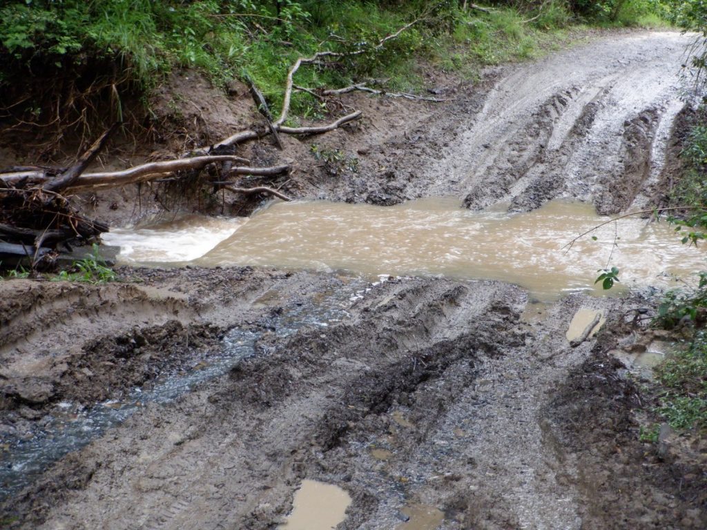
Our plan from here was to travel via Peacock Creek Road to camp in the Richmond Range National Park then over the range to Toonumbar Dam and Kyogle. The rain continued for most of the day. We have travelled this track a few times previously but this time it defeated us. Peacock Creek was flowing deep and the track was boggy. It was a concern that more rain would close the road. With great difficulty, we turned car and van around on the narrow track. We took a long way around through Casino to the Kyogle Caravan Park. It poured rain all night. Fortunately, we enjoyed a very nice dinner at a local hotel. The green frog that made a home under one of our solar panels while we were camped at Hootens Bridge, left us for the brighter lights here. We didn’t miss his happy croaking all evening.
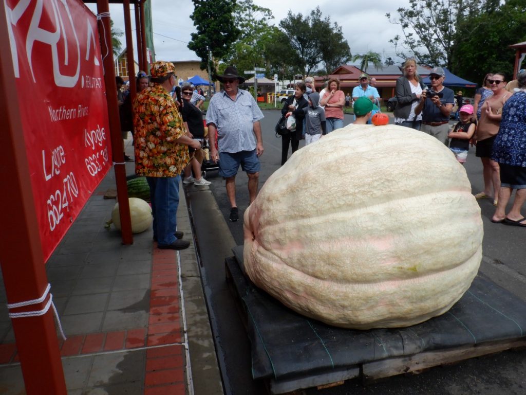
PICNIC AT THE PUMPKIN FESTIVAL: BORDER CROSSING ADVENTURES
This was the first time on this trip that we pulled out a blanket for the evening. Before departing town the next morning, we couldn’t resist a decadent morning tea at the local bakery and were surprised to stumble upon the ‘Biggest Pumpkin’ festival. There was also a ‘guess the weight’ competition. Quite a crowd had gathered for the weigh in. The winning pumpkin weighed in at 869kg, creating a new record for the southern hemisphere.
GRADYS CREEK BORDER CROSSING ADVENTURES
Our last night was spent at The Rainforest Gateway on Gradys Creek, just 9km along the Lions Road. We were aware that this road was unsuitable for towing a caravan further along. With the border closed, we would need to divert back along the Summerland Way to the coast.
The privately-run campground on Gradys Creek offered basic cabins as well as tent and caravan sites. It would be a convenient spot to camp to explore the Border Ranges if the National Parks’ facilities were not to a camper’s taste. The Lions Road connects New South Wales and Queensland over the McPherson Range. It is a narrow one-lane road in parts with many creek crossings. The funding, planning and labour for the road came from the Lions Club of Kyogle. Despite the New South Wales Government rejecting the idea in 1969, it was opened the following year, an astonishing feat by volunteers. In 1990 it was sealed with bitumen.
OUR ROUTE
The route we followed for this get-away was not as planned but we enjoyed the spectacular scenery, craggy peaks, dense rainforests, birdlife, friendly locals, and fantastic local produce everywhere. We explored new territory. The Scenic Rim of Southern Queensland was an easy escape from the Gold Coast. The Border Ranges of Northern New South Wales warrant more exploration next time! ■
Have you been on a recent trip? Email us atNicole@sunkissmedia.com.au

Editor for Silver Magazine Gold Coast